Think I'll go outside for a while
--The O'Jays, "It's a Beautiful Morning"
Day Three
 Tuesday was a beautiful day. Sunshine and cool temps. A perfect day for a walk in the park. Which is exactly what we came there to do (among other things). Our first hike of the day was planned as a loop, first to the sister peaks of the North and South Bubbles (I call them peaks, but the highest point on the island is 1500 feet), then down to Jordan Pond and up Mount Pemetic, before returning to our starting point.
We headed first to the South Bubble, to see Balance Rock, a huge boulder left sitting on the edge of the South Bubble when the glaciers of the last Ice Age receded. It looks pretty precariously set, but it has been there for 10,000 years or so (I assume), so it must be as stable as anything else in nature (refer to the second law of thermodynamics). The hike to the rock was pretty easy and very pleasant, with juncos and a few warblers calling in the cool morning air. In some places the sun peaked through the trees, in other places, the trees cleared and allowed the sun to fill the clearing. It was a welcomed change from the gray skies of the previous two days. At the peak,
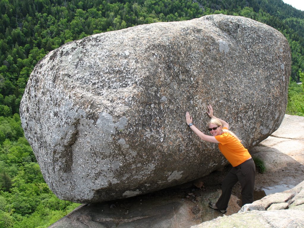 the views were as good as they get from 500 feet. At the rock, Monkey gave it a push to ensure that it was indeed stable (what if it had fallen, I wonder--we would have skulked home as quickly as a pair of Monkeys can skulk, I imagine). From the top, we could see a bus stop on the road below--a bus tour of the park. We waved, not expecting the driver to see us, or care, if he did; to our surprise, he honked his horn. What fun, to be a part of someone's Acadia National Park bus tour. It probably happens all the time!
From the South Bubble, we backtracked up to the North Bubble. Three hundred additional feet
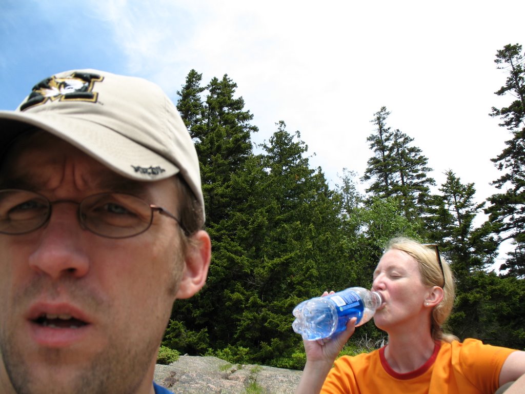
 of altitude made the views all the better! Looking south onto Jordan Pond, with the sunshine and wispy clouds, the scene was postcard-perfect. We lingered here for a while, just soaking up the sights (and some water).
Backtracking just a bit more, we headed south to Jordan Pond. Here, the rocks were still a bit wet from the rain and mist of the days before, and we found the footing ocassionally treacherous. Monkey fell once and for a few moments, she was an unhappy little Monkey, but we pushed on.
As a side note, I gotta tell you, between her falling down and my getting us lost half the time, it's a wonder we survive some of these back country excursions. But survive we do, and we really do love every minute of it (well, almost every minute of it).
The flat land around Jordan Pond was easy and pretty. This mile of our hike was the quickest and least strenuous, but (unbeknownst to us) we were about to put in some serious work!
The hike up Pemetic was long, and portions of it were steep and relatively technical (no iron
 rungs here). At points, the views were spectacular (we were ascending to over 1200 feet), and the hike was ocassionally halted so I could chase birds (most of which I never caught up with--birding in evergreen is a dicey proposition, I learned in Oregon). At the peak of Pemetic, however, the view was not quite as good as some of the other portions of the hike up the mountain. Because of the terrain at the top, you don't get the same panoramic view as on other mountains, and the long plateau doesn't allow for spectacular "drop off"-type scenes. But it was a good hike, nonetheless.
According to the map, it looked like our trip down was to be a tough one. We were about to descend about 800 feet in a half a mile. That is a pretty quick slope. And, guess what. Maps don't lie.
2 comments:
dude im a misplaced person... have you seen me anywhere?
Actually, maps do sometimes lie. I mean, have you ever used MapQuest? But I digress....
You are some hard core monkeys, hiking those challenging trails and braving the treachery. All that and fashionable too!
Anon AMVB
Post a Comment